
Hikes in the United States
Hikes in the United States range from a 2.9-mile Bryce Canyon loop rated moderate to multi-week wilderness thru-hikes like the 211-mile John Muir Trail. Routes include out-and-back, loop, point-to-point and thru-hike formats, with difficulty running from moderate to expert-only and most official seasons falling between late spring and fall.
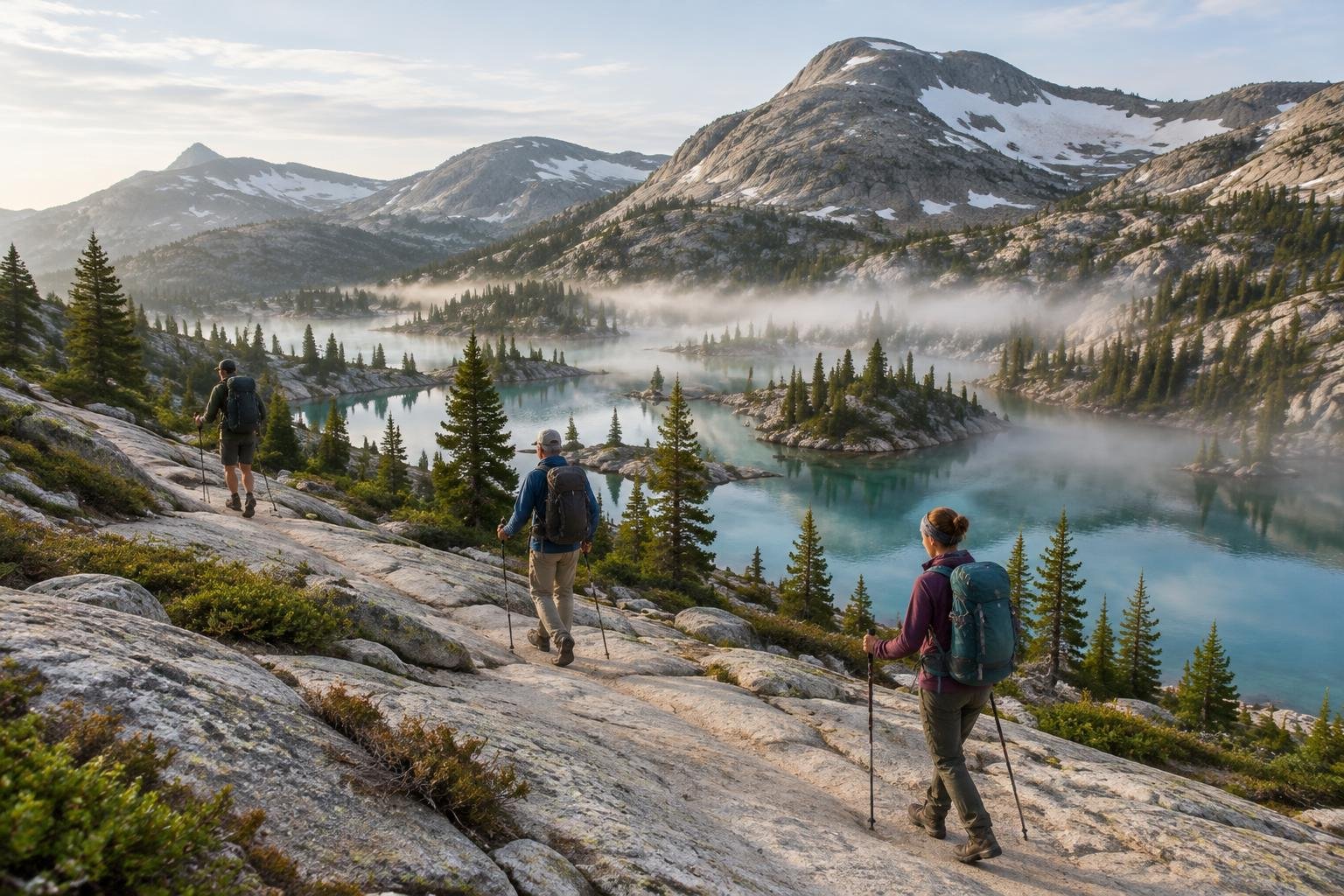
This collection gathers 23 trails across the United States, from the Sierra Nevada, Cascades and Rockies to the Colorado Plateau, the Appalachians, Texas, Alaska and Hawaii. It mixes short signature loops with long out-and-back day hikes, point-to-point ridge traverses, and multi-day circuits and thru-hikes. Managing agencies include the National Park Service, the U.S. Forest Service, state parks and a sovereign tribal nation, so rules, permits and access differ from route to route.
The routes at a glance
-
Half Dome & Yosemite Valley · Sierra Nevada · California, USA
Half Dome and Yosemite Valley is a 14–16 mile out-and-back with about 4,800 feet of gain, rated very strenuous. It suits fit, experienced hikers, and the season depends on when the cables are up, so check the National Park Service for this year's dates.
- Distance
- 14–16 miles (22.5–25.7 km) round-trip
- Difficulty
- Very strenuous
- Official season
- Roughly late May to mid-October, whenever the cables are up (check NPS for this year’s dates)
-
Zion — Angels Landing & The Narrows · Colorado Plateau · Utah, USA
Zion pairs two out-and-back routes: Angels Landing, 5.4 miles with exposed chained sections and a required permit, and The Narrows, a river walk with current and flash-flood risk. It suits hikers comfortable with exposure or wading, in April to May or September to October.
- Distance
- Angels Landing: 5.4 mi (8.7 km) round-trip. The Narrows (bottom-up from Temple of Sinawava): up to ~9.4–10 mi (15–16 km) round-trip to Big Spring, or ~6 mi (9.7 km) round-trip if turning around at Wall Street
- Difficulty
- Angels Landing: Strenuous (exposed chained sections, permit required). The Narrows: Moderate to strenuous (wading a river with current and flash-flood risk, but no technical climbing)
- Official season
- April to May and September to October
-
Grand Canyon — Bright Angel Trail · Colorado Plateau · Arizona, USA
Bright Angel Trail drops from the South Rim to the Colorado River and Bright Angel Campground, 9.5 miles one-way. It is rated very strenuous, and the Park Service strongly discourages rim-to-river-to-rim in a single day. Spring and fall are the official seasons because summer inner-canyon heat is dangerous.
- Distance
- South Rim to Colorado River / Bright Angel Campground: 9.5 mi (15.3 km) one-way, ~19 mi (30.6 km) round-trip
- Difficulty
- Very strenuous (NPS strongly discourages attempting rim-to-river-to-rim in a single day, especially in summer)
- Official season
- March–May and September–November — summer inner-canyon heat is dangerous
-
Mount Whitney Trail · Sierra Nevada · California, USA
The Mount Whitney Trail is a 22-mile round-trip from Whitney Portal to the summit at 14,505 feet, with over 6,000 feet of gain. It is rated very strenuous and high-altitude, and it suits well-prepared hikers aiming for July to September, when the trail is snow-free.
- Distance
- 22 miles (35.4 km) round-trip from Whitney Portal
- Difficulty
- Very strenuous / high-altitude
- Official season
- July to September for a snow-free trail
-
John Muir Trail · Sierra Nevada · California, USA
The John Muir Trail is a 211-mile thru-hike through the Sierra Nevada with roughly 47,000 feet of cumulative gain. It crosses several passes above 11,000 to 13,000 feet and is rated very strenuous. It suits experienced backpackers planning a multi-week trip from July to September.
- Distance
- 211 miles (340 km) point-to-point
- Difficulty
- Very strenuous (multi-week wilderness thru-hike crossing several passes above 11,000–13,000 ft)
- Official season
- July to September, after most snow has melted
-
Havasu Falls — Havasupai · Grand Canyon region · Arizona, USA
Havasu Falls is a 10-mile one-way hike from Hualapai Hilltop, about 20 miles round-trip, with roughly 2,400 to 2,500 feet of descent on the way in. The climb back out in full sun is the harder direction. It is managed by the Havasupai Tribe and best in spring or fall.
- Distance
- 10 miles (16 km) one-way from Hualapai Hilltop to Havasu Falls/campground; ~20 miles (32 km) round-trip
- Difficulty
- Moderate to strenuous (mostly downhill and shaded going in; the return climb out in full sun, plus extreme summer heat and flash-flood risk, is the harder direction)
- Official season
- Spring and fall; summer is very hot with flash-flood risk
-
Rocky Mountain NP — Sky Pond & Emerald Lake · Front Range · Colorado, USA
Rocky Mountain National Park offers two separate out-and-back hikes here. Emerald Lake is about 3.6 miles round-trip and rated moderate, while Sky Pond is about 9.4 miles with a short Timberline Falls scramble and a strenuous rating. Both are best from June to September.
- Distance
- Two separate out-and-back hikes: Emerald Lake ~3.6 mi round-trip (from Bear Lake TH); Sky Pond ~9.4 mi round-trip (from Glacier Gorge TH)
- Difficulty
- Emerald Lake: Moderate. Sky Pond: Strenuous
- Official season
- June to September for the high routes once the snow clears (autumn can also be good, but conditions change quickly)
-
Appalachian Trail — McAfee Knob · Blue Ridge · Virginia, USA
McAfee Knob is an out-and-back of about 8.8 miles from the VA-311 trailhead near Catawba, with roughly 1,740 to 1,850 feet of gain. It is rated moderate to strenuous and suits hikers wanting a well-defined Appalachian Trail objective in April to June or September to November.
- Distance
- ~8.8 miles round-trip, out-and-back (from the VA-311 trailhead near Catawba)
- Difficulty
- Moderate to strenuous
- Official season
- April–June and September–November
-
Acadia National Park · Mount Desert Island · Maine, USA
Acadia here means three distinct signature trails: Precipice Loop, Beehive Loop and Cadillac North Ridge. Precipice and Beehive involve iron-rung climbs and are not for anyone uneasy with heights, while Cadillac North Ridge is moderate to strenuous. The season runs late May to October.
- Distance
- Three distinct signature trails, not one hike: Precipice Loop ~2.1–2.5 mi; Beehive Loop ~1.4–1.6 mi; Cadillac North Ridge ~4.4 mi round-trip
- Difficulty
- Precipice & Beehive: Strenuous/exposed (iron-rung climbs, not for those uncomfortable with heights). Cadillac North Ridge: Moderate to strenuous
- Official season
- Late May to October; fall foliage is a highlight
-
Bryce Canyon — Navajo & Queen’s Garden · Colorado Plateau · Utah, USA
This 2.9-mile loop has 625 feet of gain and a moderate rating from the National Park Service. It is the shortest route in this collection and suits hikers wanting a manageable outing. The rim sits near 8,000 to 9,000 feet, with a May to October season and cold nights.
- Distance
- 2.9 miles (4.6 km) loop
- Difficulty
- Moderate (NPS's own rating: "less than 1000 feet elevation gain, moderate length")
- Official season
- May to October; the rim sits near 8,000–9,000 ft with cold nights
-
Grand Teton — Cascade Canyon · Teton Range · Wyoming, USA
Cascade Canyon runs 13.6 miles round-trip from the South Jenny Lake trailhead to the Forks of Cascade Canyon, or about 8.8 miles using the seasonal Jenny Lake boat shuttle each way. With about 1,300 feet of gain, it is rated moderate to strenuous and runs June to September.
- Distance
- 13.6 miles round-trip from the South Jenny Lake trailhead to the Forks of Cascade Canyon (~8.8 mi round-trip if using the seasonal Jenny Lake boat shuttle each way)
- Difficulty
- Moderate to strenuous
- Official season
- June to September
-
Great Smokies — Alum Cave to Mount LeConte · Southern Appalachians · Tennessee, USA
The Alum Cave route to Mount LeConte is a 10-mile out-and-back with roughly 2,763 to 2,800 feet of gain, rated strenuous. It suits hikers with solid fitness who want a classic Southern Appalachian climb, with spring wildflowers and fall color between April and October.
- Distance
- 10 miles round-trip
- Difficulty
- Strenuous
- Official season
- April to October; spring wildflowers and fall color
-
Wonderland Trail — Mount Rainier · Cascades · Washington, USA
The Wonderland Trail is a roughly 93-mile loop around Mount Rainier with about 27,000 feet of cumulative gain and the same in loss. It is rated very strenuous and expert-level, a multi-day trek for experienced backpackers, open late July to September once the snow clears.
- Distance
- ~93 miles (150 km) loop
- Difficulty
- Very strenuous / expert-level multi-day trek
- Official season
- Late July to September, once the snow clears
-
The Enchantments · Alpine Lakes Wilderness · Washington, USA
The Enchantments is about 18 miles one-way, typically done as one very long day or an overnight thru-hike, with a roughly 1,900-foot Aasgard Pass climb in the Colchuck to Snow Lakes direction. It is rated very strenuous and expert-level, best from late July to October.
- Distance
- ~18 miles one-way (Stuart/Colchuck Lake trailhead to Snow Lakes trailhead), typically hiked as a single very long day-hike or overnight thru-hike
- Difficulty
- Very strenuous / expert-level
- Official season
- Late July to October, after the snow melts
-
Glacier — Highline Trail · Northern Rockies · Montana, USA
The Highline Trail is a moderate, 11.6-mile point-to-point from Logan Pass to The Loop trailhead, with about 800 feet of gain and 3,000 feet of loss. It suits hikers who want a mostly descending traverse, and it is available July to September when Logan Pass is open.
- Distance
- 11.6 miles (18.6 km) one-way, from Logan Pass to The Loop trailhead
- Difficulty
- Moderate
- Official season
- July to September, when Logan Pass is open
-
Presidential Traverse · White Mountains · New Hampshire, USA
The Presidential Traverse is a point-to-point of about 19 to 23 miles with 8,500 to 9,000 feet of gain, varying by chosen trailheads. It is rated very strenuous and expert-only, and the listing notes alpine weather is severe year-round. The season is July to September.
- Distance
- ~19–23 miles point-to-point (varies by chosen trailheads/route — not a single fixed trail)
- Difficulty
- Very strenuous / expert only
- Official season
- July to September; alpine weather is severe year-round
-
Franconia Ridge — White Mountains · White Mountains · New Hampshire, USA
Franconia Ridge is an 8.9-mile loop with about 3,900 feet of gain, rated strenuous. It climbs Falling Waters Trail, crosses Little Haystack, Mt. Lincoln and Mt. Lafayette, and descends Old Bridle Path. The ridge is exposed to fast weather, so plan for June to October.
- Distance
- 8.9 miles loop (up Falling Waters Trail, across Franconia Ridge Trail/Appalachian Trail over Little Haystack, Mt. Lincoln, and Mt. Lafayette, down Old Bridle Path)
- Difficulty
- Strenuous
- Official season
- June to October; the ridge is exposed to fast weather
-
Big Bend — South Rim & Chisos · Chihuahuan Desert · Texas, USA
Big Bend's South Rim is a 12.6-mile loop, up Laguna Meadows and down Pinnacles, with about 2,800 feet of gain and a strenuous rating. A shorter 6.3-mile one-way spur to the viewpoint also exists. The season is October to April because summer is dangerously hot.
- Distance
- 12.6-mile loop (Laguna Meadows Trail up, Pinnacles Trail down) is the standard full South Rim Loop; a shorter 6.3-mile one-way spur to the South Rim viewpoint also exists for those returning the way they came
- Difficulty
- Strenuous
- Official season
- October to April; summer is dangerously hot
-
Kalalau Trail — Nā Pali Coast · Nā Pali Coast · Kauai, Hawaii, USA
The Kalalau Trail runs 11 miles one-way along the Nā Pali Coast, 22 miles round-trip, with about 5,000 feet of cumulative gain across five valleys. It is rated very strenuous and expert-only: narrow, exposed, and prone to landslides and flash floods year-round. Summer is drier.
- Distance
- 11 miles (17.7 km) one-way; 22 miles (35.4 km) round-trip
- Difficulty
- Very strenuous / expert only (narrow, exposed, landslide- and flash-flood-prone)
- Official season
- Drier summer months; flash floods are a year-round risk
-
Harding Icefield Trail · Kenai Peninsula · Alaska, USA
The Harding Icefield Trail is an 8.2-mile out-and-back on the Kenai Peninsula with about 3,000 feet of gain, rated strenuous. It suits fit day hikers who want a sustained climb toward the icefield, best from late June to September once the upper trail is snow-free.
- Distance
- 8.2 miles (13.2 km) round-trip
- Difficulty
- Strenuous
- Official season
- Late June to September, once the upper trail is snow-free
-
PCT — Goat Rocks & the Knife’s Edge · Cascades · Washington, USA
This Goat Rocks route is most often a 20 to 25 mile out-and-back day hike that joins the PCT past Old Snowy Mountain and across the Knife's Edge. It is rated strenuous to very strenuous, with an exposed narrow ridge and snowfields common into midsummer. Late July to September is the season.
- Distance
- Most often hiked as a ~20-25 mile out-and-back day hike from the Snowgrass Flat or Berry Patch trailhead, joining the PCT past Old Snowy Mountain and across the Knife's Edge; on the PCT itself this section runs roughly 28-30 miles point-to-point between White Pass and Walupt Lake. The narrow 'Knife's Edge' ridge proper (PCT mile marker ~2284.5-2287) is only about 2-2.5 miles long.
- Difficulty
- Strenuous to very strenuous — high alpine, exposed narrow ridge with steep drop-offs, snowfields common into midsummer, hypothermia-death incidents on record
- Official season
- Late July to September, once the snow clears
-
PCT — High Sierra & Forester Pass · Sierra Nevada · California, USA
Forester Pass, at 13,153 feet, is the highest point on the PCT. The direct climb from the Bubbs Creek Trail junction is 7.9 miles one-way, while most hikers reach it on 46 to 49 mile backpacking trips via Kearsarge Pass. It is very strenuous and can hold snow into July.
- Distance
- Forester Pass (13,153 ft) is the single highest point on the entire 2,650-mile PCT. The direct PCT climb to the pass from the PCT/Bubbs Creek Trail junction is 7.9 miles one-way. Most hikers experience it as part of a multi-day High Sierra trip via the Kearsarge Pass Trailhead (Onion Valley) — round-trip backpacking routes to and past the pass run roughly 46-49 miles.
- Difficulty
- Very strenuous / high alpine — the PCT's highest and one of its most exposed passes, often holds snow/ice into July
- Official season
- July to September (later in heavy snow years)
-
CDT — Wind River Range · Rockies · Wyoming, USA
The CDT through the Wind River Range runs roughly 100 miles point-to-point from South Pass City to Togwotee Pass. Thru-hikers often detour onto alternates such as the Cirque of the Towers or the Knapsack Col route. It is very strenuous, remote and high-alpine, with limited resupply, from July to September.
- Distance
- The CDT runs roughly 100 miles through the Wind River Range, point-to-point from South Pass City to Togwotee Pass, crossing the Bridger-Teton and Shoshone National Forests. Many thru-hikers detour onto high-alpine alternates within this stretch, such as the Cirque of the Towers alternate (~9 miles one-way via the Big Sandy Trailhead and Jackass Pass, or 17-40+ mile loop variants) and the Knapsack Col cross-country route (crossing the crest at ~12,200 ft).
- Difficulty
- Very strenuous / high alpine — remote, high-elevation wilderness with multiple passes at or above treeline, limited resupply
- Official season
- July to September
How to choose between them
Start with effort and time. Bryce Canyon's Navajo and Queen's Garden loop is rated moderate at 2.9 miles, while Half Dome, Mount Whitney and the Grand Canyon's Bright Angel Trail are very strenuous. If you want a point-to-point day, the Glacier Highline Trail is moderate. For exposure, note Angels Landing, Acadia's Precipice and Beehive, and the Goat Rocks Knife's Edge. Multi-day commitments include the Wonderland Trail and John Muir Trail. Check permit needs, which apply to Angels Landing, and managing agencies before committing.
When to go
Official seasons cluster between late spring and fall. Desert and canyon routes such as Bright Angel Trail, Havasu Falls and Zion favor spring and fall, and Big Bend runs October to April because summer is dangerously hot. High-alpine routes like the Wonderland Trail, John Muir Trail, Enchantments and Forester Pass generally open from July or later once snow melts. Acadia and Bryce Canyon run from May or late May. Confirm current dates, closures and conditions with each managing authority before you go.
Common questions
Which hikes in the United States are the shortest?
Among the listed routes, Acadia's Beehive Loop at about 1.4 to 1.6 miles and Precipice Loop at about 2.1 to 2.5 miles are the shortest, though both are strenuous and exposed. Bryce Canyon's Navajo and Queen's Garden loop is 2.9 miles and rated moderate.
Which trails here are multi-day thru-hikes or circuits?
The John Muir Trail is a 211-mile thru-hike, the Wonderland Trail is a roughly 93-mile loop, and the Enchantments is a thru-hike of about 18 miles one-way. The CDT through the Wind River Range runs roughly 100 miles point-to-point. All are rated very strenuous.
Which hikes involve exposure or serious hazards?
Angels Landing has exposed chained sections and needs a permit, and The Narrows carries flash-flood risk. Acadia's Precipice and Beehive use iron-rung climbs. Kalalau Trail is narrow and exposed, and the Goat Rocks Knife's Edge has steep drop-offs. Check conditions with the managing authority first.
When is the best time to hike these trails?
It varies. Desert and canyon routes favor spring and fall, high-alpine routes generally open from July or later, and Big Bend runs October to April. Each trail page lists its official season, and you should confirm dates with the managing authority.
Sources
Facts come from each route's official managing authority, linked on its trail guide:
- U.S. National Park Service — nps.gov/yose (Half Dome & Yosemite Valley)
- U.S. National Park Service — nps.gov/zion (Zion — Angels Landing & The Narrows)
- U.S. National Park Service — nps.gov/grca (Grand Canyon — Bright Angel Trail)
- U.S. Forest Service & National Park Service — fs.usda.gov/inyo (Mount Whitney Trail)
- U.S. National Park Service & Forest Service — nps.gov (JMT) (John Muir Trail)
- Havasupai Tribe (sovereign nation) — havasupaireservations.com (Havasu Falls — Havasupai)
- U.S. National Park Service — nps.gov/romo (Rocky Mountain NP — Sky Pond & Emerald Lake)
- Appalachian Trail Conservancy & NPS — nps.gov/appa (Appalachian Trail Park Office) (Appalachian Trail — McAfee Knob)
- U.S. National Park Service — nps.gov/acad (Acadia National Park)
- U.S. National Park Service — nps.gov/brca (Bryce Canyon — Navajo & Queen’s Garden)
- U.S. National Park Service — nps.gov/grte (Grand Teton — Cascade Canyon)
- U.S. National Park Service — nps.gov/grsm (Great Smokies — Alum Cave to Mount LeConte)
- U.S. National Park Service — nps.gov/mora (Wonderland Trail — Mount Rainier)
- U.S. Forest Service — fs.usda.gov (Enchantments, Okanogan-Wenatchee National Forest) (The Enchantments)
- U.S. National Park Service — nps.gov/glac (Glacier — Highline Trail)
- U.S. Forest Service (White Mountain National Forest) — fs.usda.gov (White Mountain National Forest) (Presidential Traverse)
- U.S. Forest Service (White Mountain National Forest) — fs.usda.gov (Franconia Ridge — White Mountains)
- U.S. National Park Service — nps.gov/bibe (Big Bend — South Rim & Chisos)
- Hawaii State Parks (DLNR) — dlnr.hawaii.gov (Kalalau Trail — Nā Pali Coast)
- U.S. National Park Service — nps.gov/kefj (Harding Icefield Trail) (Harding Icefield Trail)
- U.S. Forest Service — fs.usda.gov (Gifford Pinchot National Forest, wilderness areas) (PCT — Goat Rocks & the Knife’s Edge)
- U.S. National Park Service & Forest Service — nps.gov/seki (Sequoia & Kings Canyon wilderness permits) (PCT — High Sierra & Forester Pass)
- U.S. Forest Service — fs.usda.gov (Bridger-Teton National Forest, Bridger Wilderness) (CDT — Wind River Range)
Conditions, permits and access rules change without notice — confirm current information with each managing authority before you go. See our editorial policy.