
West Highland Way vs Causeway Coast Way: Which Should You Hike?
Choose the West Highland Way if you want a week-long Scottish Highlands thru-hike with sustained daily mileage and an exposed moor crossing; choose the Causeway Coast Way if you want a shorter coastal walk of a few days, or day sections from one base, with cliff paths and the Giant's Causeway at the midpoint.
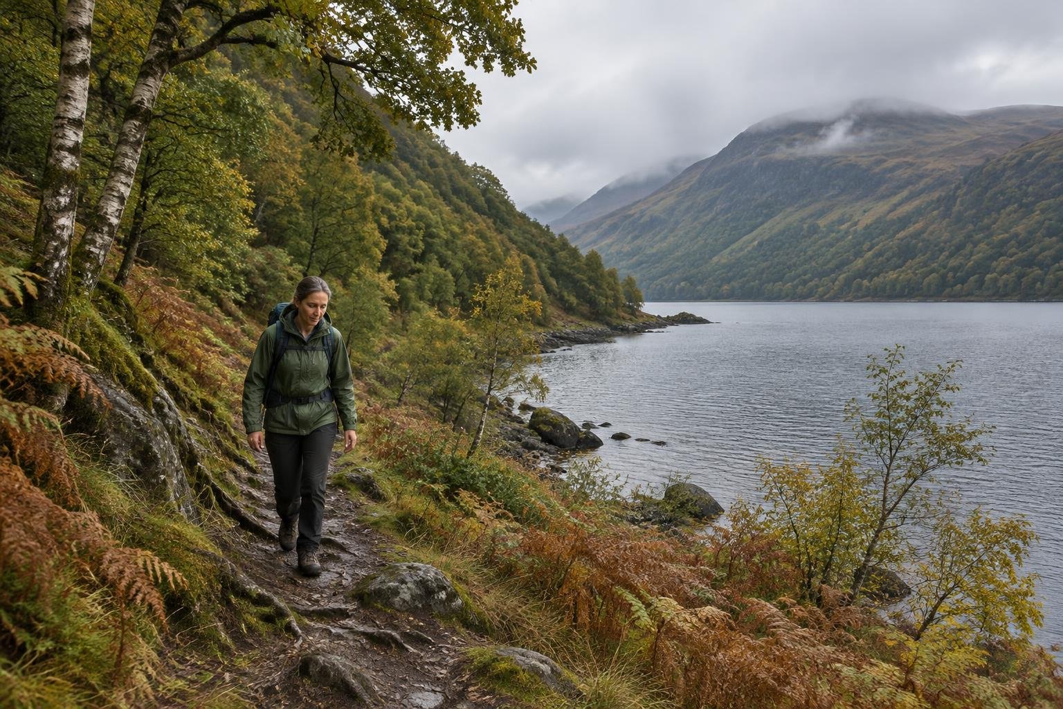
West Highland Way and Causeway Coast Way at a glance
The West Highland Way is a 96-mile (154 km) point-to-point route from Milngavie to Fort William, typically walked over 5-8 days. The Causeway Coast Way runs about 31-33 miles (50-53 km) from Portstewart to Ballycastle, usually over 2-4 days. People weigh them because both are point-to-point, best from April to October, and tied to famous landscapes.
| West Highland Way | Causeway Coast Way | |
|---|---|---|
| Place | Scottish Highlands · Scotland | County Antrim · Northern Ireland |
| Distance | 96 miles / 154 km, point-to-point (Milngavie to Fort William) | ~50–53 km / 31–33 mi, point-to-point, Portstewart to Ballycastle (Giant's Causeway falls roughly mid-route), typically walked over 2–4 days |
| Elevation gain | ~3,155 m (10,351 ft) per Scotland's Great Trails official designation; note some independent trail guides/GPS-based trackers report notably higher cumulative gain (roughly 4,020-4,800 m / 13,200-16,150 ft) from counting minor undulations differently | ~1,300 m / 4,288 ft cumulative elevation gain over the full route (GPS-aggregated); not a mountain walk — highest point is only around 150 m, but the path repeatedly climbs in and out of bays and along cliff sections |
| Difficulty | Moderate to strenuous (long-distance, multi-day; no technical climbing, but sustained daily mileage and an exposed crossing of Rannoch Moor) | Moderate — low-lying coastal path overall, but with some steep, exposed cliff-edge sections |
| Route type | point-to-point (thru-hike, typically walked over 5-8 days) | point-to-point |
| Official season | April to October | April to October |
| Managed by | West Highland Way / local authorities | National Trust & local councils |
Effort and difficulty
The West Highland Way is the bigger commitment. At 96 miles (154 km), it carries an official elevation gain of about 3,155 m (10,351 ft), and some trackers report notably higher totals. Its difficulty is described as moderate to strenuous, with sustained daily mileage and an exposed Rannoch Moor crossing. The Causeway Coast Way is described as moderate, with about 1,300 m (4,288 ft) of cumulative gain, a highest point around 150 m, and repeated climbs in and out of bays plus some steep, exposed cliff sections.

Season, permits and booking
Both routes list April to October as the official best season. The West Highland Way needs no permit, and wild camping is generally allowed under Scottish access rights, but seasonal byelaws restrict it along parts of Loch Lomond, where managed campsites are required. The Causeway Coast Way also needs no permit, though the Giant's Causeway visitor center charges for its facilities and parking. Cliff paths can be slick, and tides matter. Confirm current rules with each managing authority before you go.
Which one is right for you?
Choose West Highland Way if…
Pick the West Highland Way if you have around a week, want a true long-distance walk and are comfortable with sustained daily mileage. It suits hikers who enjoy changing landscapes, from Loch Lomond's rooty shoreline to open Rannoch Moor and the Devil's Staircase. It also rewards people willing to book overnight stops in advance and keep early stages conservative.
How to hike West Highland WayChoose Causeway Coast Way if…
Pick the Causeway Coast Way if you have two to four days, or prefer day walks from one town using the coastal bus. It suits hikers who like cliff-top paths, beaches and headlands, and who want flexibility to swap sections depending on wind. Plan around tide tables, and consider visiting the Causeway stretch early or late in the day when it is quieter.
How to hike Causeway Coast Way — Giant’s CausewayWhat the two have in common
Both are point-to-point routes with an April to October best season, and neither requires a permit to walk. Each is a linear journey through a distinctive landscape, with overnight stops in towns or villages along the way. Both also depend heavily on weather, with exposure to wind playing a major role, and both reward planning bookings, transport and timing before you set out.
How your choice changes what you pack
The West Highland Way points toward a larger pack for multiple days, with layers for wind on open moorland, plus camping gear if you use managed campsites. The Causeway Coast Way suits a lighter daypack when you move between towns or hike sections, but wind-proof layers and grippy footwear matter for exposed, slick cliff paths and wet rock.
Common questions
Which is harder, the West Highland Way or the Causeway Coast Way?
The West Highland Way is the harder of the two. It is described as moderate to strenuous, with long daily mileage and an exposed moor crossing, while the Causeway Coast Way is described as moderate. Cliff sections on the coast can still be steep and exposed.
Which is better for a first long-distance walk?
The Causeway Coast Way is the shorter commitment, and its itinerary notes say the route never strays far from a road or a bed, with the option of day sections. The West Highland Way is a longer thru-hike, so it suits those ready for a week of walking.
Do I need a permit for either route?
Neither route requires a permit to walk. The West Highland Way has seasonal byelaws restricting wild camping along parts of Loch Lomond. The Giant's Causeway visitor center charges for its facilities and parking. Check current rules with each managing authority.
When is the best time to hike each one?
Both list April to October as the official best season. Weather exposure is a factor on each route, with open moorland on the West Highland Way and Atlantic wind on the Causeway Coast Way. Confirm current conditions before you set out.
Sources
- West Highland Way / local authorities — westhighlandway.org: official information for West Highland Way.
- National Trust & local councils — nationaltrust.org.uk (Giant’s Causeway): official information for Causeway Coast Way.
Conditions, permits and access rules change without notice — confirm current information with each managing authority before you go. See our editorial policy.